Anne is a photographer who shoots a wide variety of outdoor subjects, and Gene is a watercolor artist.
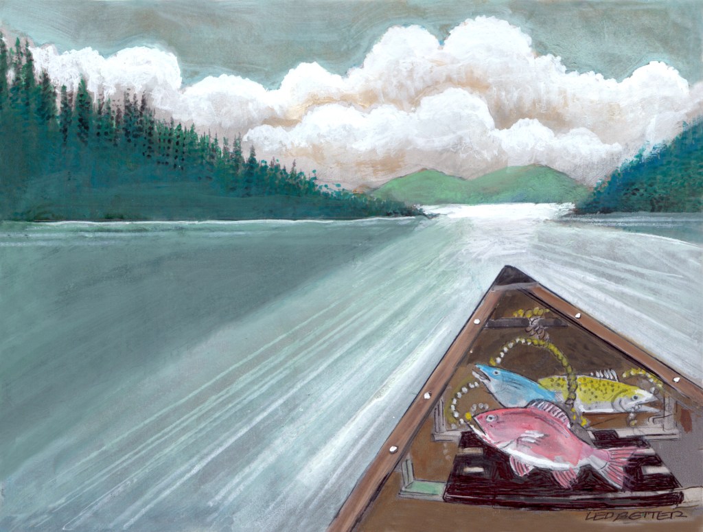
Before Covid-19, Gene found his inspiration from books and other sources, but now is limited in what he can do. Gene, searching for new material, started drawing on a copy of one of Anne’s photographs. That idea started what has become an interesting collaborative effort.
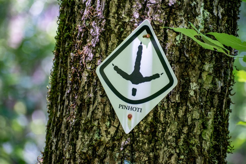
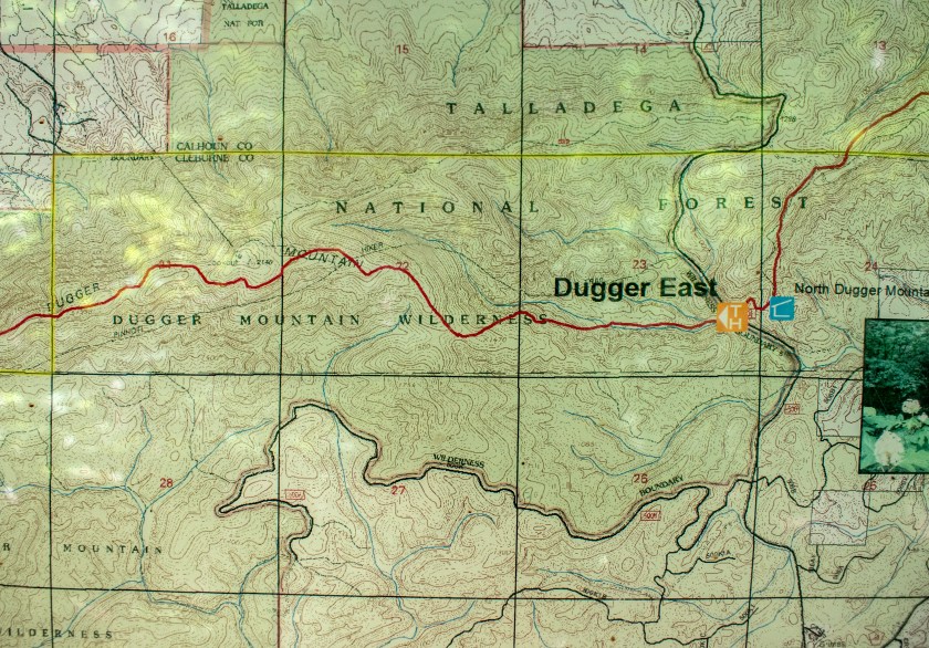
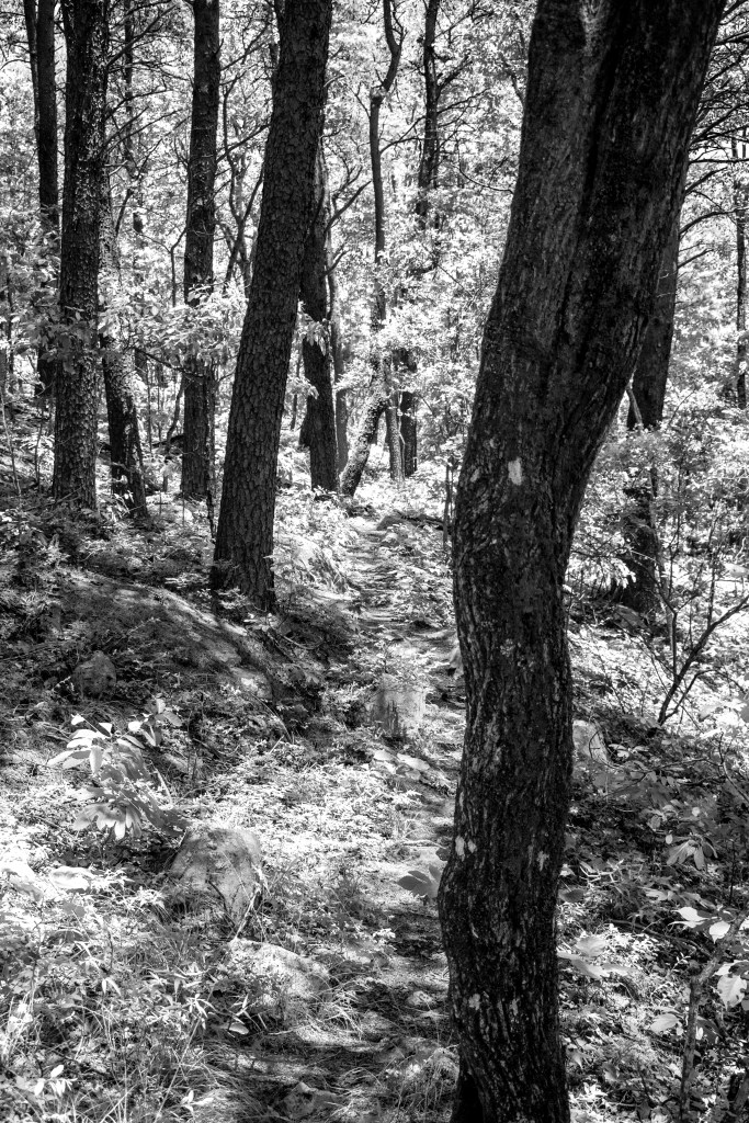
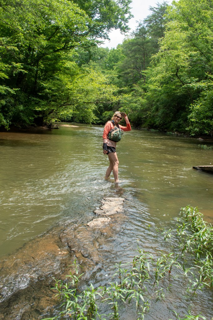
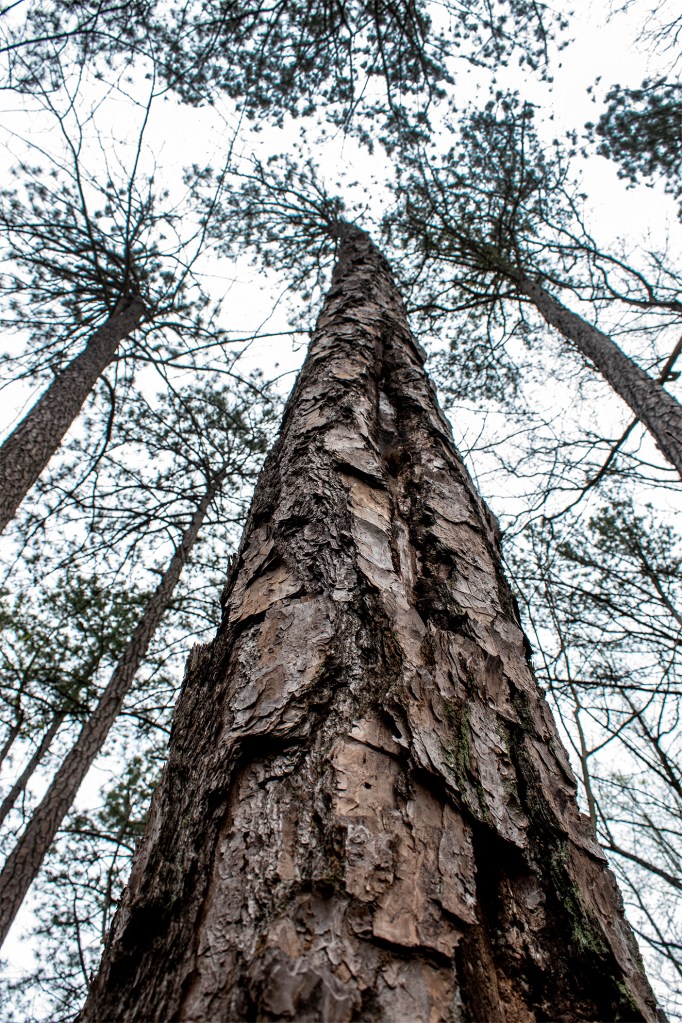
We took some time off from the paddle boards to hike a bit of Section 11 of the Pinhoti trail in Alabama. Our goal was to use different muscles, see some different scenery and to avoid crowds. We definitely succeeded in all those aims.
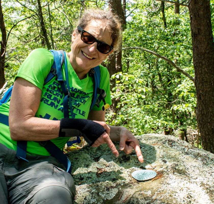
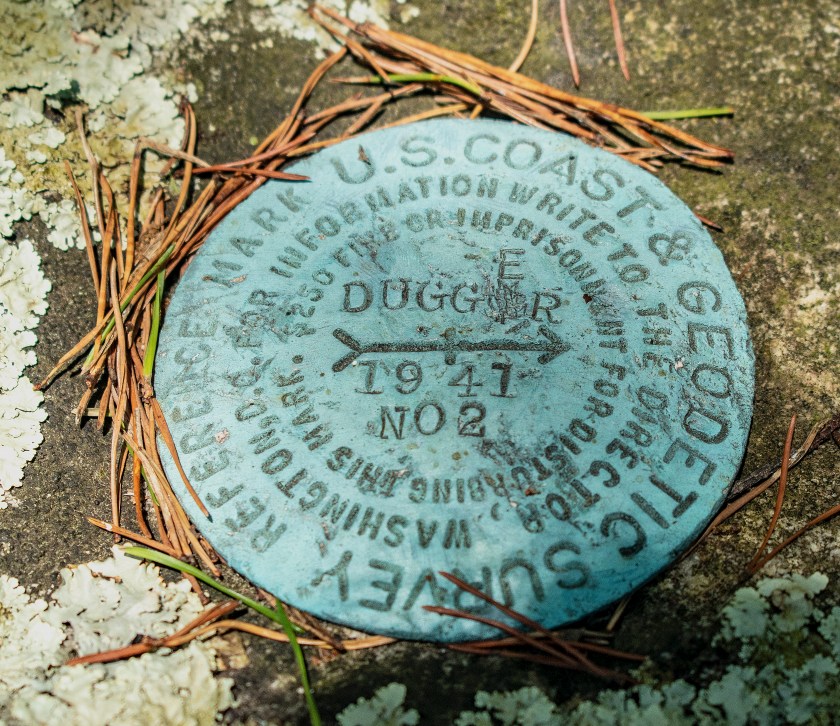
We hiked about 2.5 miles from the northern terminus of Section 11 at FS 500 to the summit of Dugger Mountain, heading basically west. We actually passed the summit, before deciding to take a little off trail jaunt in search of the summit. We followed a spur with an interesting line of exposed rock and came to a fairly flat and almost open area. Here, we found the footings of an old fire tower that had to be removed as Dugger Mountain is in a wilderness area. We could make out a slightly higher mound of rock and investigated. This was the actual summit as evidenced by USGS survey markers.
It’s hard to characterize this hike. Exploring off trail to find the summit was interesting as were the wild flowers, but, on the whole, it was a hot and fairly unremarkable trip. I think the hike would be better as a shuttle starting from the Burns trailhead because the creek near FS 500 is really pretty and would be a great place to finish.
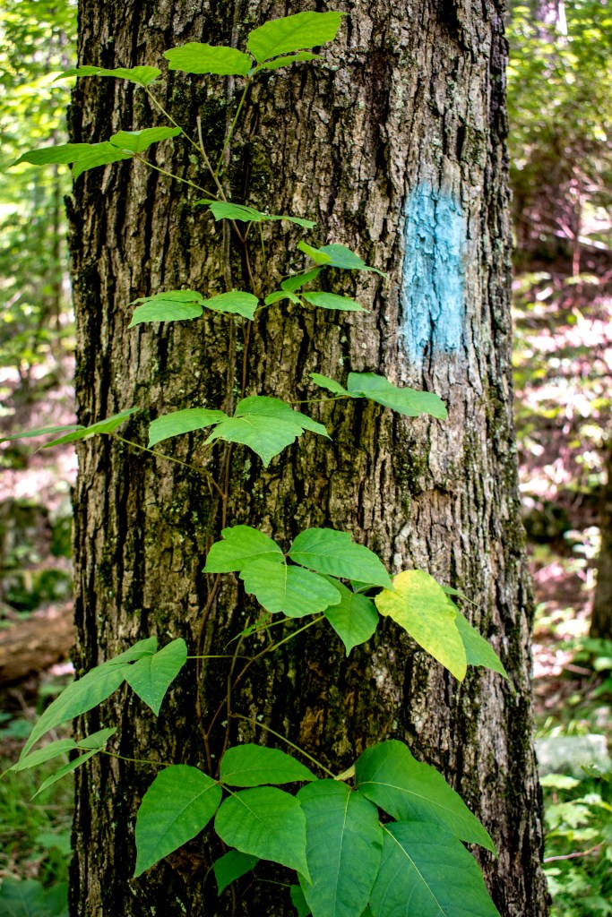
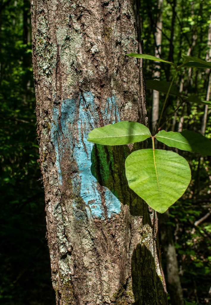
The remoteness of the area certainly added to the experience. We didn’t see anyone else on the trail. The tread of the trail was fairly narrow owing to the relative lack of use. However, our main memory of the trail may be the prevalence of poison ivy – it was everywhere – and there was no avoiding it.
As I mentioned, the late spring wild flowers were interesting.
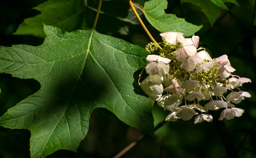
Steve loves oakleaf hydrangeas, and we saw many of these as we started our hike along a creek.
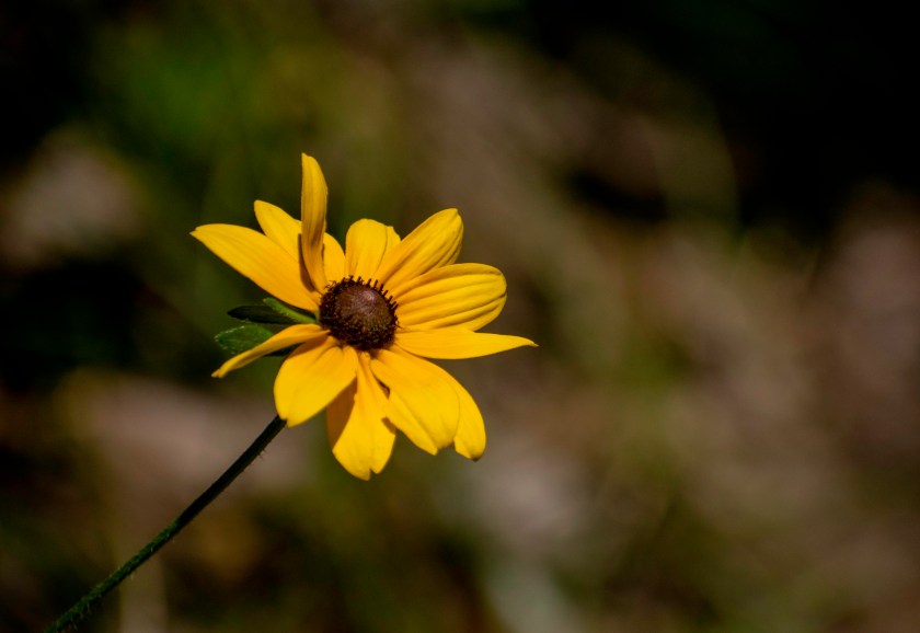
We saw plenty of black-eyed susans.
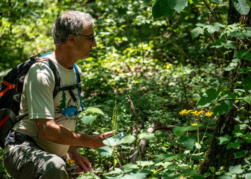
Steve’s working on capturing a cell phone shot.
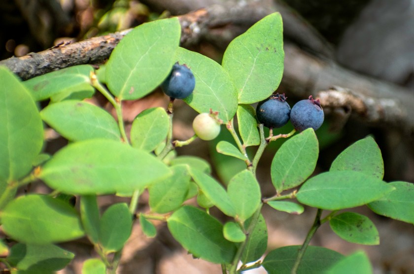
We found some early blue berries near the summit for a sweet trailside treat.
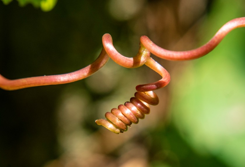
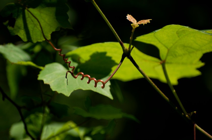
There were wild grapes along the trail too, and the tendrils can make interesting images.
The image below is processed as if it were infrared. Green foliage looks white because it is warmer.
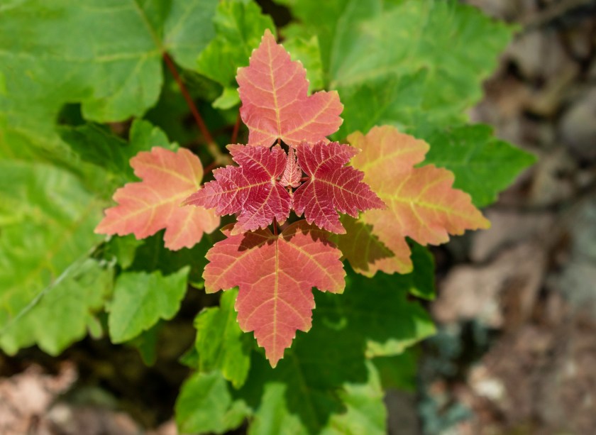
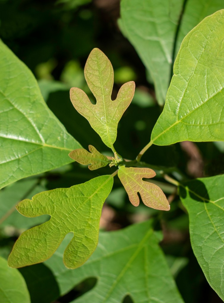
Young leaves are often reddish to protect them from sun damage while they are still growing. Here are sugar maple and sassafras leaves with this coloration. Anne is particularly attracted to the ‘Dr Seuss’ quality of sassafras leaves.
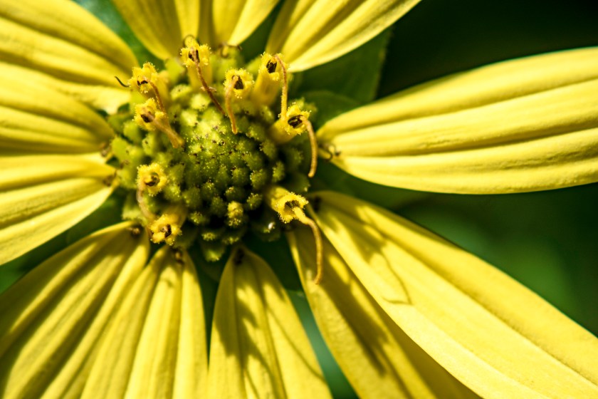
A detailed image of a rough stem rosinweed shows how complicated a simple flower really is.
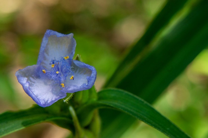
Light hitting a zig zag spiderwort.
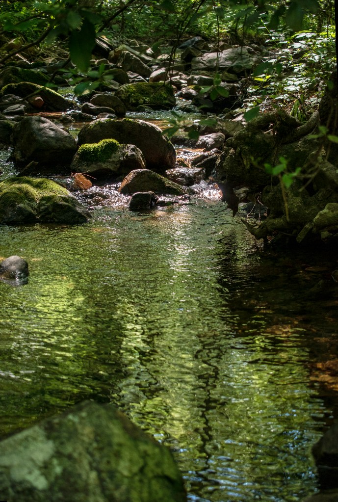
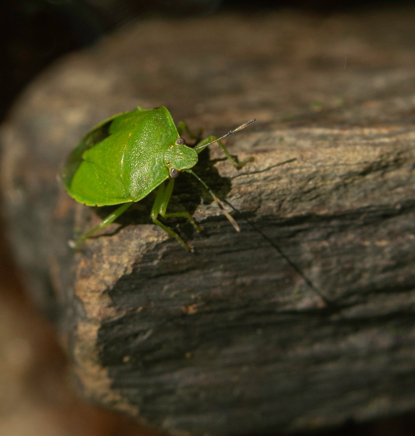
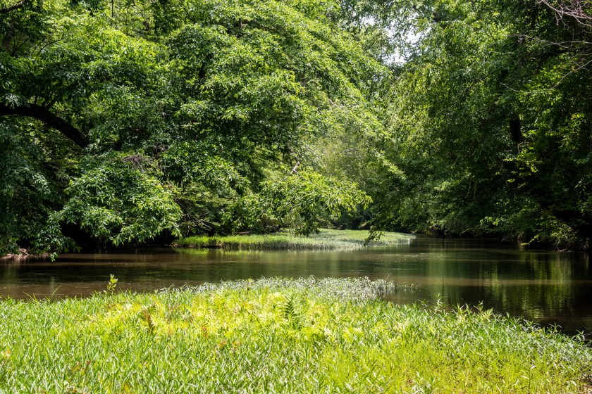
There was a great creek at the end of our hike where we enjoyed a picnic lunch.
This little guy was hanging out on a rock in the creek.
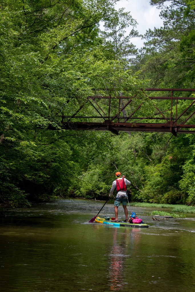
Steve and I were very sad to hear that Georgia River Network needed to cancel the 2020 Paddle Georgia due to the COVID-19 pandemic. We were looking forward to seeing old friends and paddling the Flint.
However, paddlers can still participate in the Pandemic Edition, running rivers on their own to make up for the miles lost from missing Paddle Georgia.
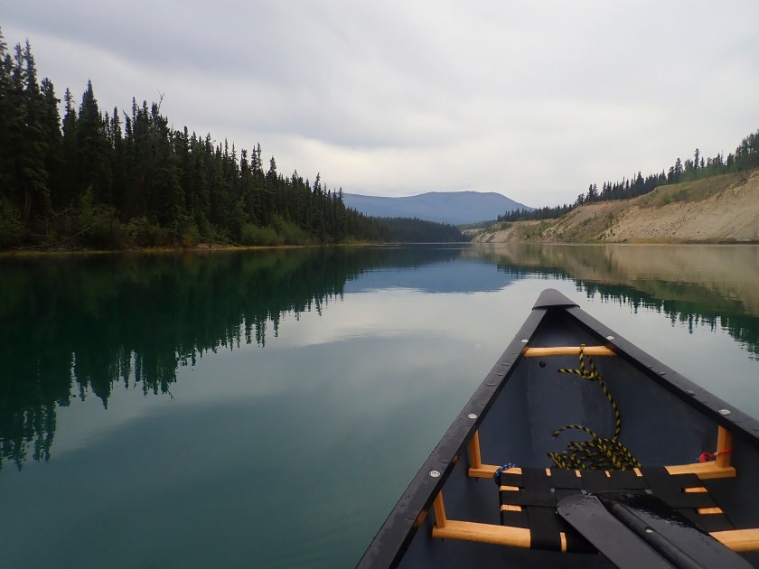
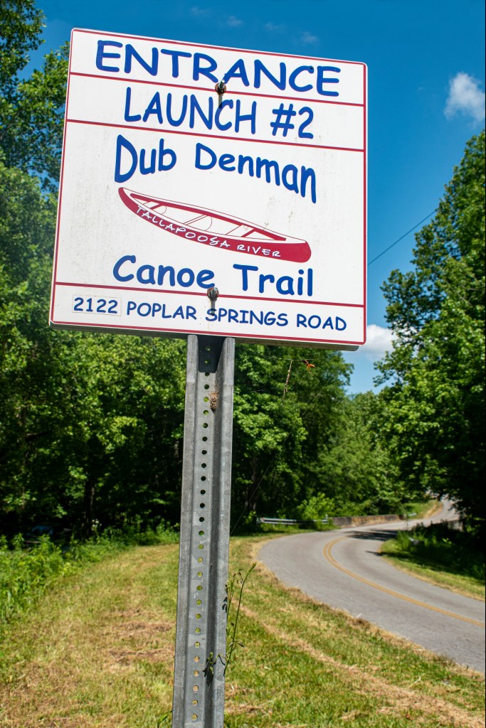
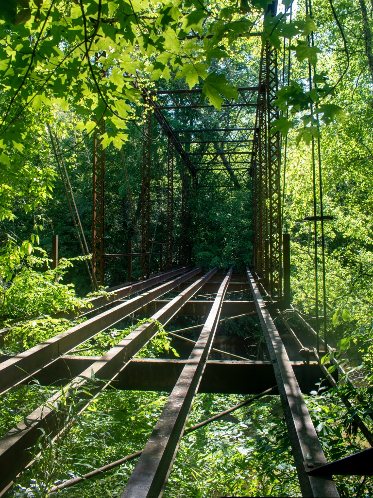
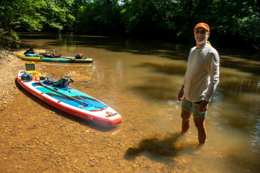
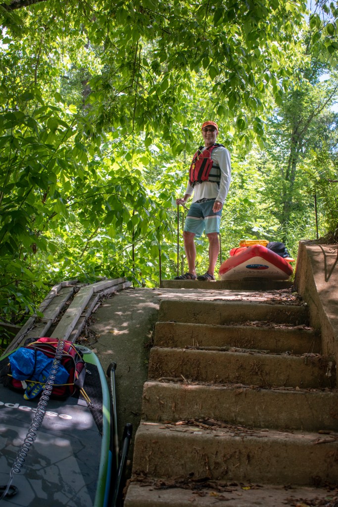
Here is my story of paddling about 20 miles of the Tallapoosa River on the Dub Denman Canoe Trail. We paddled sections 2 and 3 on our first trip, and section 1 on our second visit. Many thanks to Haralson County for their help with paddle the poosa.
Our first experience with the Tallapoosa River was a 9.5 mile trip from Poplar Springs to Broad Street. Our paddle started just below the Mize Bridge at the Poplar Springs ramp. The metal bridge is a Pratt through truss design that was built in 1897 and abandoned in 1982.
The river was running a little higher than normal due to recent rain, so the water was a bit more cloudy and sand bars harder to find. We still found great places to play in the water.
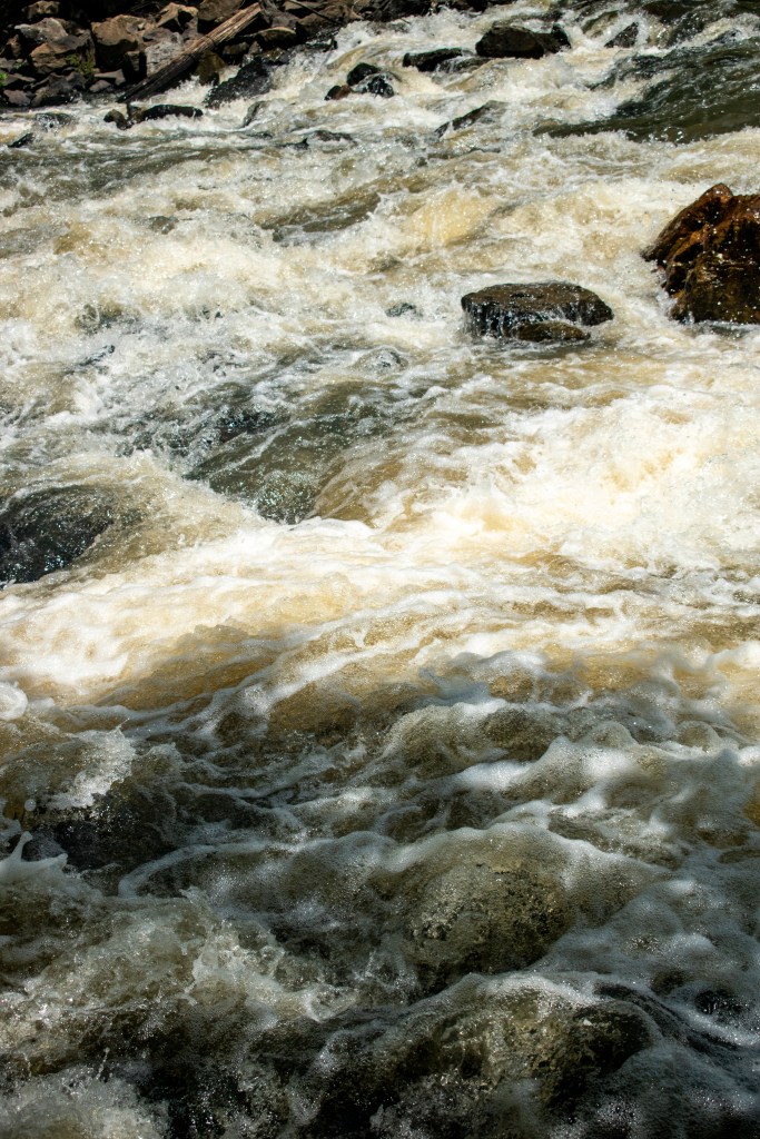
There is a small dam at the end of section 2, a short distance upstream from where the river goes under the Hwy 100 bridge. There is a paved portage route on “river left” just before the dam and is an easy way around the drop off.
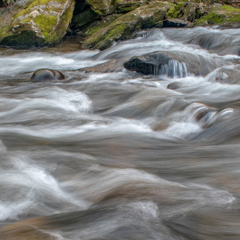
I love images of rushing water, they can show a combination of chaos and order at the same time. Here is a shot of water running over the dam by Hwy 100.
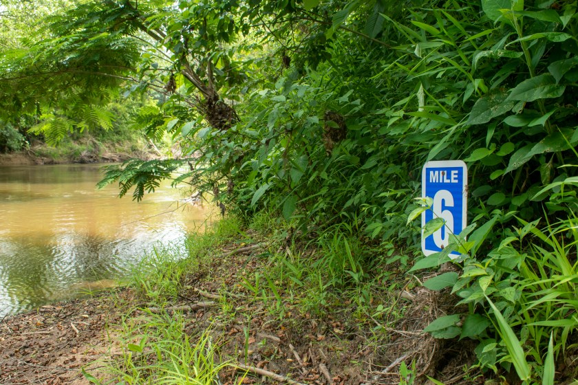
One of the trail markers along the river.
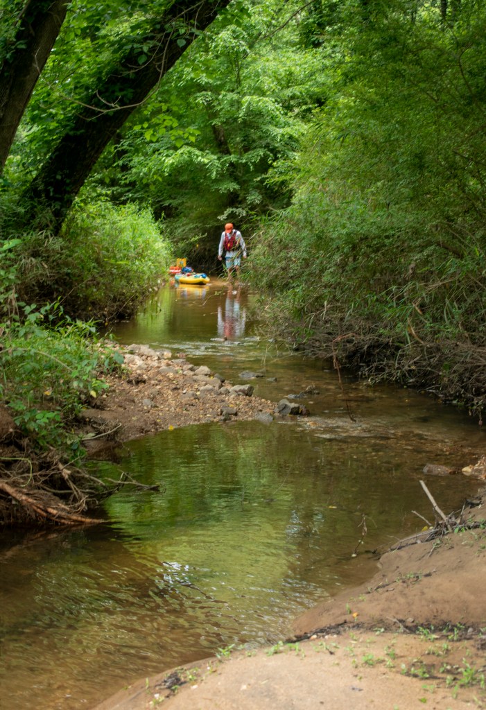
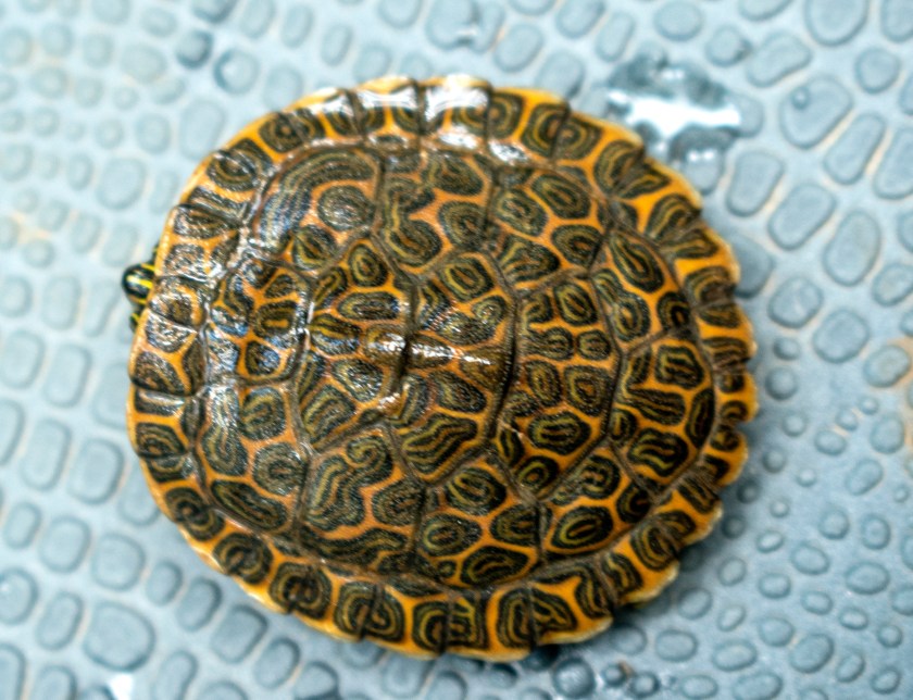
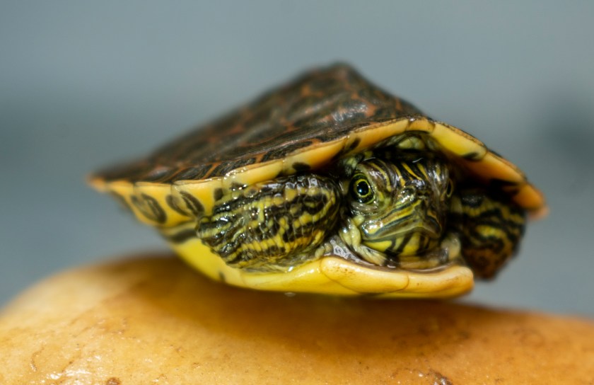
We like exploring tributaries when we float a river. Our side trip was special because we met a little river cooter pictured below.
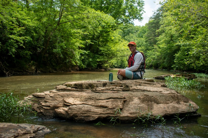
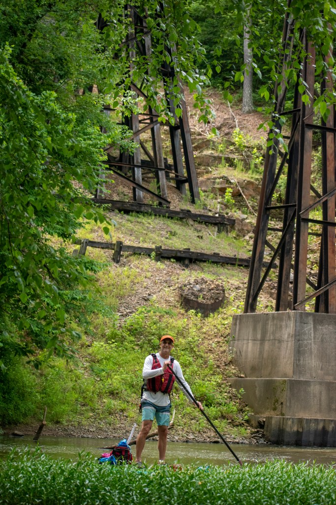
For our second trip on the Tallapoosa, we paddled from Hwy 27 to Poplar Springs, a distance of almost 10 miles. Section one felt more remote, even like a mountain stream in places. We even saw a couple of otters that were too quick for photos.
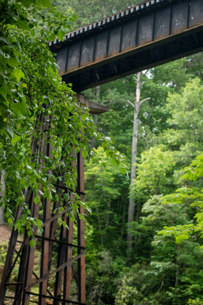
There is an active rail line that crosses the river near the Hwy 27 put in.
Our lunch stop on a gravel bar provided one of the highlights of our day. We stopped for lunch here. I was moving through the vegetation taking photos, and a small fawn that had been hiding in the knee high weeds took off running. It was way too quick and surprising to even get my camera focused.
Looking down the river at the old steel bridge before taking out at the Poplar Springs ramp which marked the end of a great day on the Tallapoosa.
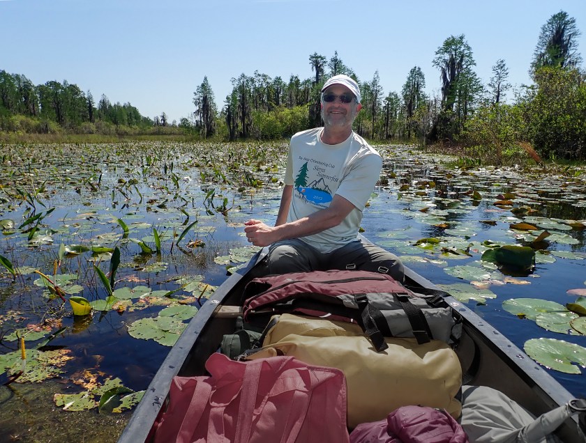
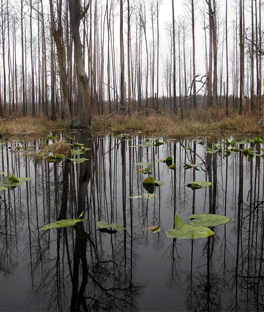
These images come from one of our many trips to the Okefenokee. This trip was in April 2018 and was our first visit in the spring as we usually go in the middle of the winter. We were really curious to see what the swamp would be like in Spring.
We were also excited about a meteor shower that we were going to watch in the darkness of the swamp. As it turned out, rain and clouds obscured the celestial show, but were not disappointed because the dramatic clouds and rain gave us just another kind of beauty.
We travel by canoe instead of kayak as it is much easier to haul gear and get out of the boat to access camping platforms.
Right now, the Okefenokee is being threatened by potential mining. Please take a look at what you can do to help protect the swamp at Georgia River Network. Public comments are open until May 28th
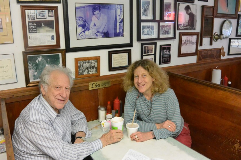
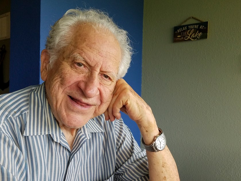
It is dad’s 93rd birthday today and I have been thinking of some of the wonderful trips we have taken. These photos come from a trip to the Mississippi river where we explored parts of the state of Mississippi and upriver to Memphis, Tennessee. This trip was really fun and the memories bring me comfort in this time of covid-19.
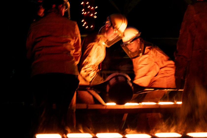
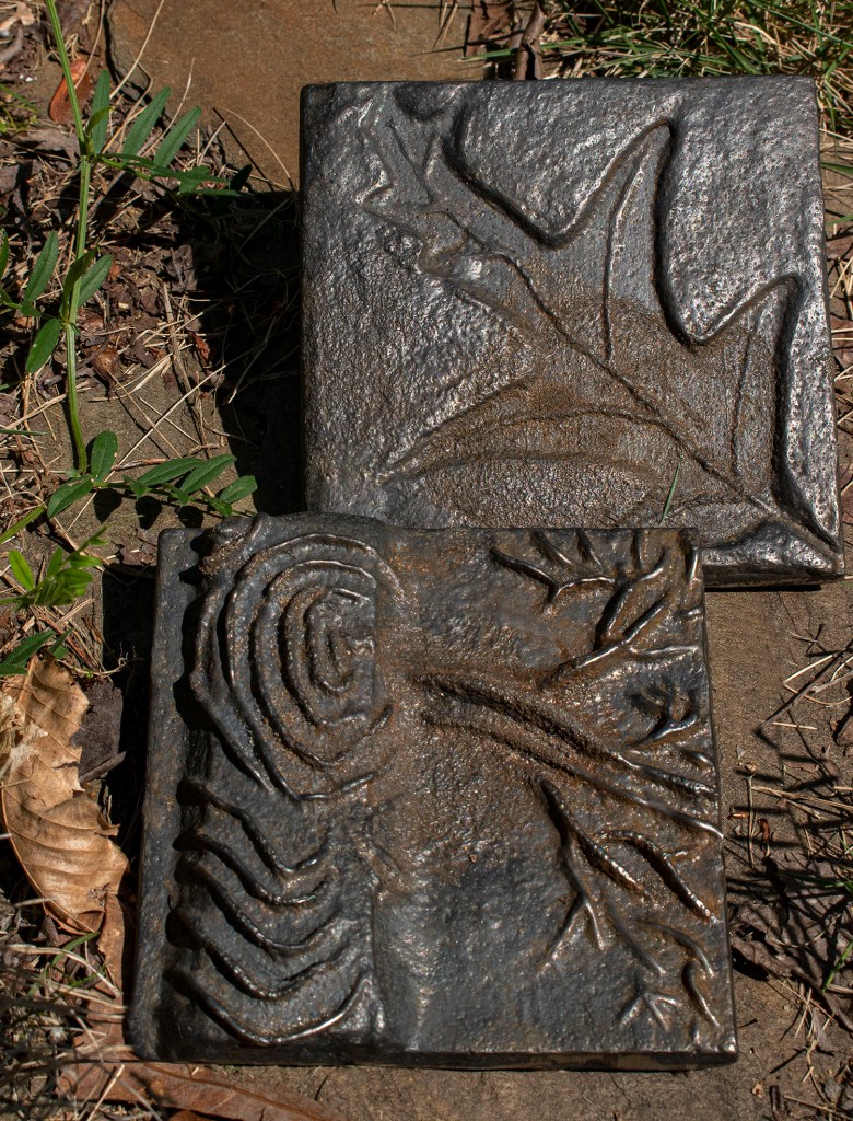
Just before COVID-19 really took hold, Steve and I had a wonderful date day at Red Top Mountain state park. We went to one of their iron pours to test our scratch block carving skills.
You purchase a scratch block from the visitor’s center and settle down to design and carve the block that will later be filled with molten iron.
The blocks themselves were rather soft and we found that the best tools to carve were nails and even a paper clip for detailed work.
We turned in our blocks, and then waited for dark and the real excitement — the firing of the furnace and pouring of the iron.
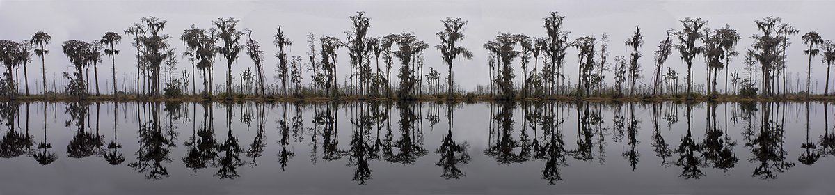
This is a really complicated landscape, but it the same time it has a strange organization to it. The image has some of my favorite subjects in it -reflections, seeing through water, mountains, clouds and the color blue all over it
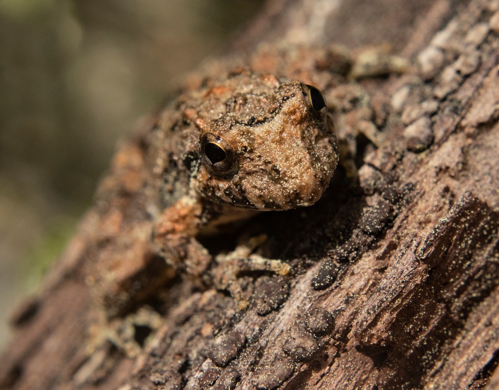
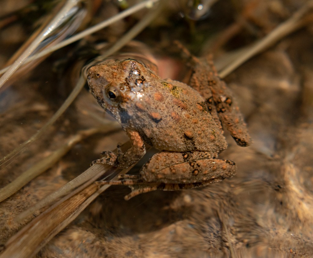
We had a great trip to Red Top Mountain State Park in spite of the air being thick with spring pollen. We kept our walk short and focused on the upper end of a small creek that popped up out of a spring. We were in for treat as there were a lot of small frogs to be seen.
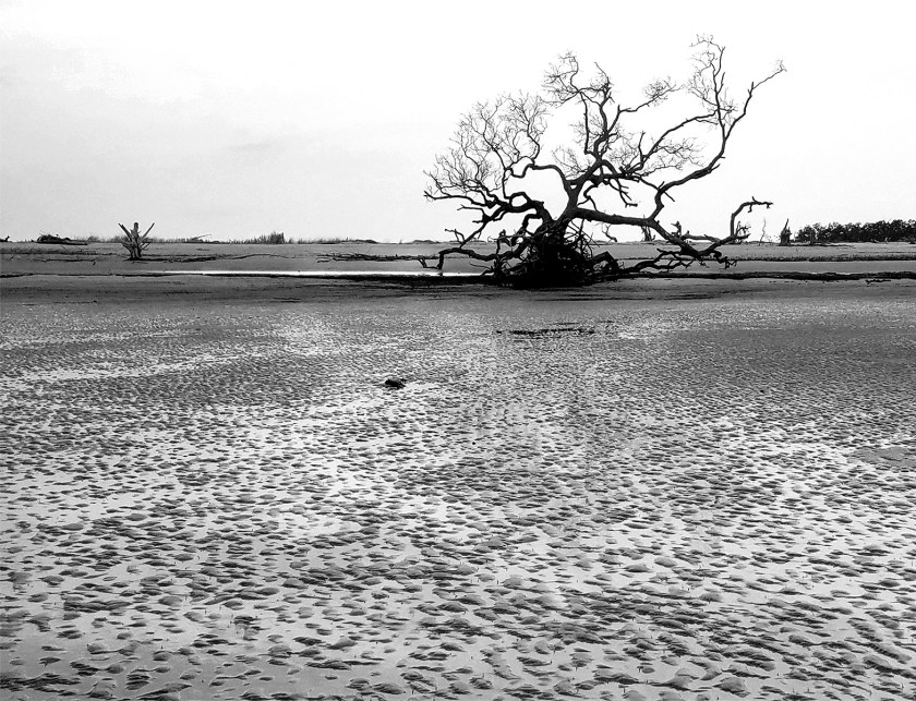
I like the starkness with its feeling of quiet and solitude. The image is calming at first glance but, as I look longer, I notice the textures of the sand and tree and feel more intrigued to explore.
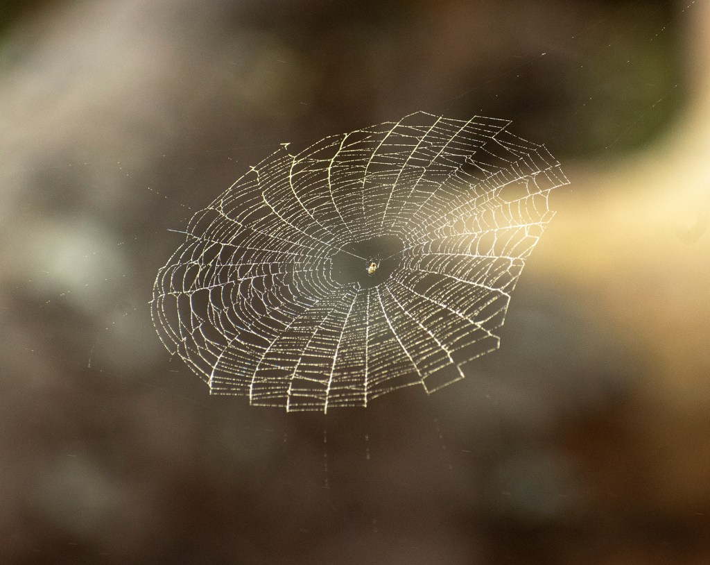
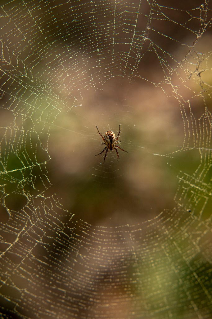
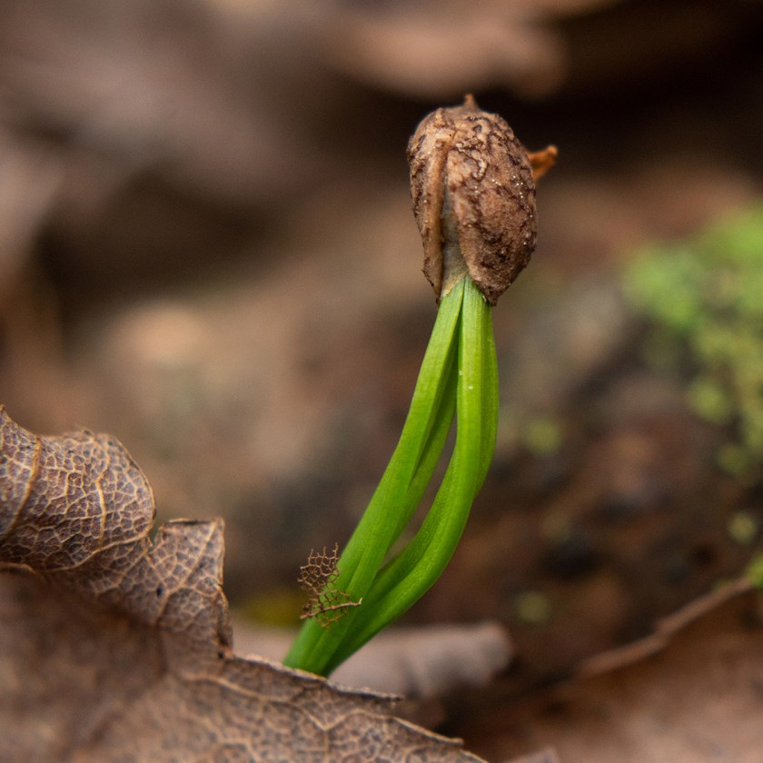
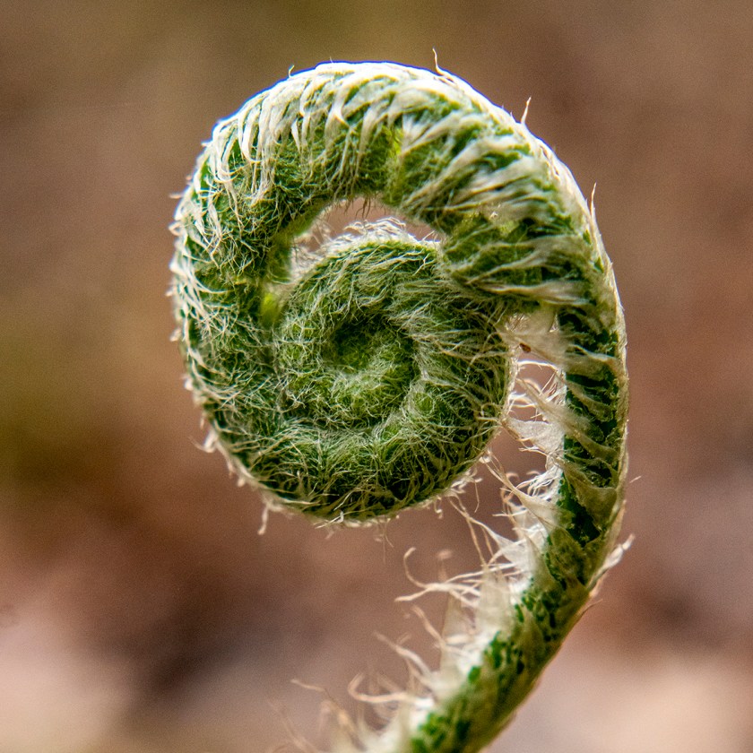
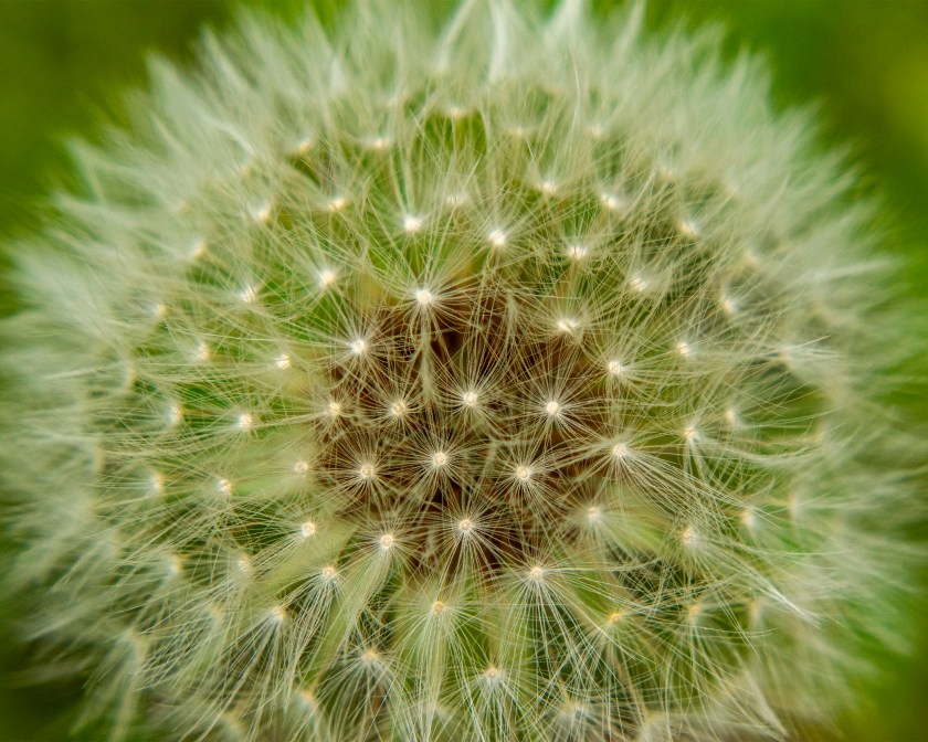
We’re staying close to home with all the covid-19 restrictions, but it’s a great time to appreciate things we might not normally see. We went to Red Top Mountain State Park to do a little off trail exploring and found some very interesting signs of spring.
First, this is my Dad and the image reminds me of his engagement with life and his surroundings. His expression is engaging and makes me want to talk to him
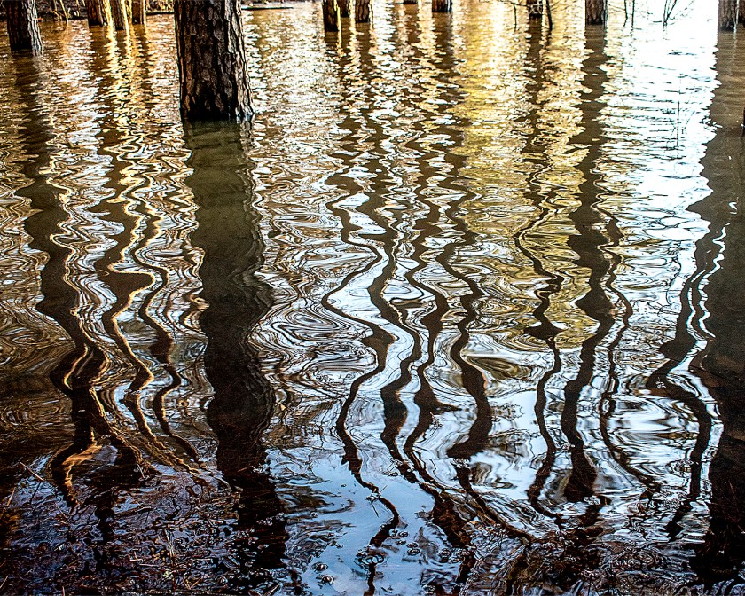
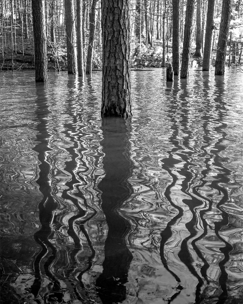
Lake Allatoona flooded again this year providing a great opportunity for unique photographs. I was amazed at how changing my position by a few feet gave such different images.